


INDIANA — Federal forecasters released the National Oceanic and Atmospheric Administration’s (NOAA) outlook on Thursday, predicting that a “very strong” El Niño climate pattern will play a central role in shaping weather across the country in the coming months.
The atmospheric phenomenon is expected to alter traditional storm tracks, creating a distinct shift in seasonal patterns across the nation.

“As we know from decades of observations, a very strong El Niño will likely bring a southward and eastward shift to the jet stream for the contiguous U.S., which tilts the odds toward stormier weather across the South,” said Ken Graham, director of NOAA’s National Weather Service, in a news release.
For the Midwest and much of Indiana, NOAA’s forecast leans toward above-normal temperatures from December through February. However, seasonal precipitation remains a toss-up: meteorologists predict equal chances for below-average, near-average, or above-average total precipitation amounts across the state.
Forecasters emphasize that NOAA’s seasonal outlook indicates only whether overall temperatures and precipitation are expected to deviate from normal—it does not predict exact precipitation totals or specify whether it will fall as rain, snow, or ice.
What a Typical Winter Looks Like in Central Indiana
To put the seasonal outlook into context, typical winter weather in Indianapolis features the following climate normals (based on National Weather Service data from 1991 to 2020):
- December: Average high of 40°F; average low in the lower 20s to low 30s; up to three inches of precipitation.
- January: Average high of 36°F, average low in the lower 20s. January is the snowiest month, averaging eight to nine inches of snow.
- February: Average high of 41°F; 2.4 inches of precipitation.
- March: Average high of 52°F; 3.7 inches of precipitation as winter transitions into spring.
In addition to federal forecasts, private long-range publications have released their own projections for the 2026–2027 winter season.
Farmers’ Almanac predicts quick cold snaps and volatility
The Farmers’ Almanac urges Midwesterners to keep snow shovels, rain boots, and ice scrapers handy, warning of “sudden snow squalls, blustery winds, and bursts of bitter cold.” The publication notes that precipitation will be particularly difficult to pinpoint because frequent temperatures near freezing could cause conditions to rapidly swing between rain and snow.
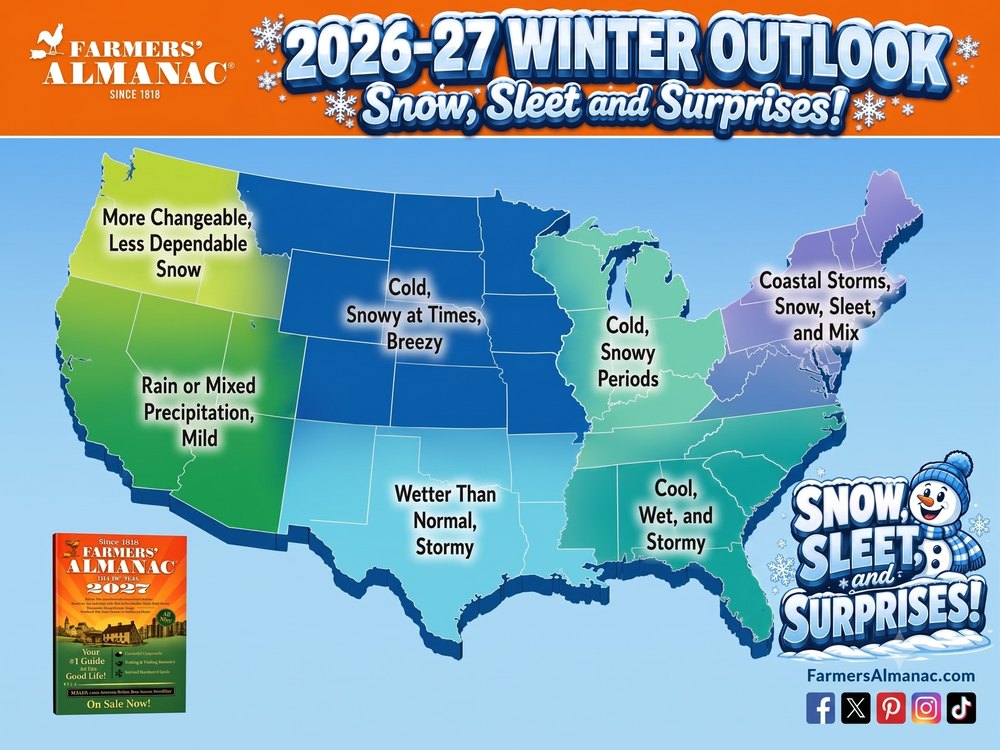
While the Farmers’ Almanac claims an accuracy rate of 80% to 85%, an independent study by the University of Illinois highlighted in Popular Mechanics calculated its historical accuracy closer to 52%.
Old Farmer’s Almanac: A Divided State
The Old Farmer’s Almanac presents a split prediction for Indiana depending on geography:
- Northern Indiana (“Lower Lakes” Region): Forecasted to experience above-normal temperatures and precipitation, with the coldest and snowiest stretches hitting in early January and February.
- Southern Indiana (Ohio Valley Region): Forecasted to see colder, below-normal temperatures with less overall precipitation. The snowiest periods for the southern half of the state are projected for late January, mid-February, and early March.
With varying indicators across different forecast models, Hoosiers are encouraged to stay prepared and monitor local daily updates provided by the National Weather Service and WBIW 1340 AM and WBIW.com throughout the season.