

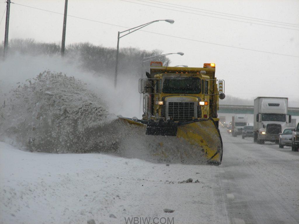
INDIANA – Emergency Management Agencies across central Indiana are preparing for winter weather in the coming days.
Those officials say they are busy coordinating with other local agencies and departments to make sure everyone is ready for incoming winter weather.
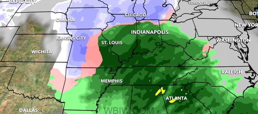
A powerful storm unleashes dangerous blizzard conditions across the central and eastern US, shutting down highways and stranding drivers in frigid temperatures.
At the same time, parts of the South are being pummeled with hail and heavy flooding. More than 40 million people are under severe storm threats today, according to the Storm Prediction Center, with an enhanced risk in effect from the Florida Panhandle to the Carolinas.
The fast-moving storm is making its way east and will cover over 1,800 miles in 72 hours, producing notable snowfall across more than half a dozen states. Flood watches are also in effect for cities like Atlanta, Charlotte, Washington, DC, Philadelphia, and New York City, where rainfall up to 4 inches is possible.
Indiana will also be wet and windy as temperatures climb into the middle 40s by late afternoon.
Wind gusts could reach up to 30 mph in spots today, while rainfall totals will exceed an inch in many spots.
The National Weather Service has issued a Hazardous Weather Outlook for Bartholomew, Brown, Daviess, Greene, Jackson, Lawrence, Martin, and Monroe Counties.
Rain is expected throughout the day, which should transition back to snow late tonight. Accumulations of a few tenths to nearly an inch are possible. Winds will increase throughout the day, and maximum gusts of up to 40 miles per hour are possible from late evening through the overnight hours.
On Wednesday through Monday, rain on any untreated roads may freeze Wednesday.
Another storm system should impact central Indiana Friday into Saturday. This system could bring widespread rain or snow to the region. It is too early for exact details, but stay tuned for updates.
Temperatures well below normal are possible for early next week. Exact values are still uncertain but lows near or below zero are possible for a few mornings.
While road crews are already getting ready to treat streets and plow any snow, drivers must also start thinking ahead. Indiana State Police said drivers should expect longer travel times in the coming days. Sergeant John Perrine reminds drivers to use extra patience and extra caution.
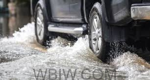
Driving on flooded roads is never a good idea. The safest way to drive through water is to avoid it whenever possible. If you’re driving and encounter floodwater on the road, turn around if you can safely do so and take another route.
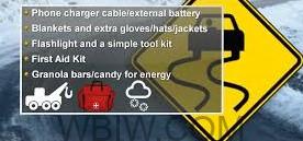
Emergency Management said it is also important to prepare for roadside emergencies. Have water, snacks, and blankets if you slide off the road or have an issue.
For those who do not need to leave home, make sure doors and windows are sealed. Officials also say to change furnace filters and ensure your furnace is in good working condition. Don’t try to heat your house with alternative methods due to carbon monoxide poisoning. Never use a generator inside the home if you lose power.
Hoosier should prepare for additional winter weather this weekend, and officials are encouraging people to stay home and off the roads unless it is for work or other critical travel.

