

INDIANA – Tens of millions of people across the US are at risk of severe storms this week that could impact Thanksgiving travel.
One notable storm system is headed into the south after blowing through the Rockies over the weekend, leaving heavy mountain snowfall piled nearly a foot high in parts of Utah, Nevada, and Colorado.
The day with the most weather-related headaches for travelers is likely to be Tuesday, with a low-pressure system bringing rain and thunderstorms to the majority of the eastern half of the country.
Several areas expecting rain include major airport cities — New York, Washington, Chicago, and Atlanta. All could see delays and frustrations due to the wet forecast.
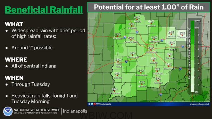
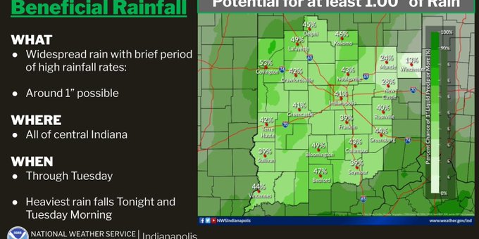
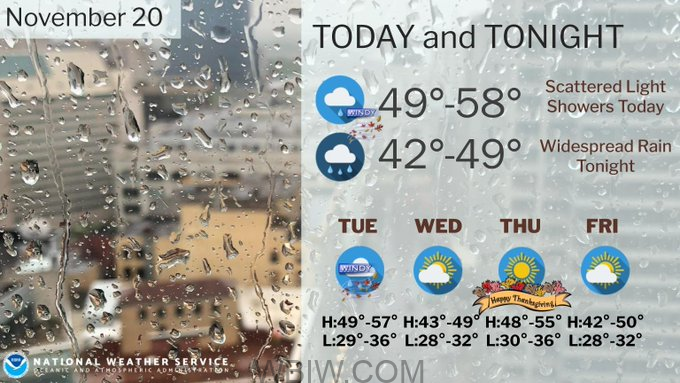
In Lawrence County, scattered light showers will develop today, with rain becoming widespread and briefly heavy tonight into Tuesday morning. Locally heavy rainfall is possible. Rain will end by Tuesday evening, with around an inch possible across much of central Indiana. Temperatures will be at a low 46° F. Winds will be from the east-southeast at 10 to 15 mph.
This cross-country storm comes as the Transportation Security Administration said it expects its busiest holiday season ever.
The busiest and most expensive days to fly before Thanksgiving will be Tuesday, Nov. 21, and Wednesday, Nov. 22, according to AAA.
The busiest day on the roads is expected to be Wednesday, Nov. 22, according to transportation analytics company INRIX. Drivers should leave home in the morning or after 6 p.m. to avoid the heaviest traffic, INRIX said.

