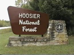
(BEDFORD) – After assessment and maintenance since the first of three storms hit the Hoosier National Forest on June 17, 2019, some trails and areas affected by closures will reopen July 4, 2019.
Specifically, the temporary emergency closure orders that closed the Charles C. Deam Peninsula Area and all Brownstown Ranger District trails have been lifted.
However, several new closure orders are now being implemented which will temporarily close certain trails and campsites that have been determined to be too damaged and dangerous for public use.
These orders state:
The following areas are ordered closed until termination of this emergency closure order or 120 days from the signature date, whichever comes first:
- The following areas of the Charles C. Deam Wilderness, as noted in Exhibit A, Closure Order 09-12-19-018 :
a. The entire Peninsula Trail, from the junction with the Grubb Ridge loop in T 7N, R 1E, Section 12 in Brown County, north to its end at Monroe Lake State Reservoir;
b. Designated campsites 21 and 22 within the Charles C. Deam Wilderness.
- The following sections of the Hickory Ridge Trail in Jackson, Lawrence, and Monroe Counties on the Brownstown Ranger District, as noted in Exhibit A, Closure Order 09-12-19-017:
a. Trail 3 from the junction with trail 12 to the junction with trail 3, north of Squirrel Farm Rd in Jackson, Lawrence, and Monroe Counties;
b. Trail 4 from the junction with McPike Branch Rd., eastward to Hickory Grove Church in Lawrence County;
c. Trail 16 from the junction of trail 17 on the west to junction with trail 17 on the east, south of trail 17 in Jackson County.
These emergency closures will be in place until Forest Service personnel are able to take appropriate measures to ensure visitor safety.
While all the trails in the Shirley Creek trail system are now open, visitors should be aware that hazards may still exist. One such hazard is a sink hole near trail 3, which starts at the junction of Shirley Creek trail one in T 35 N, R 2 W, Section 35, and County Rd. 775 and goes in a westerly direction to the junction with Shirley Creek trail 2 in T 35 N, R 2 W, Section 34. The sink hole has been flagged to warn trail users, but users should remain vigilant to this and other conditions that may hamper travel.
While most trails within the Brownstown Ranger District are now open, visitors should be aware that hazards may still exist. Additional rain and storm activity are expected across the forest over the next week. Conditions may continue to worsen over the coming days. Forest visitors are urged to use extreme caution when driving or walking in forested areas, or when using trails and campgrounds. Flash flooding, wind, standing water, falling and downed trees, and water logged ground continue to impose potential hazards to visitor safety. In particular, the Deam Wilderness Peninsula Area still has many downed trees.
Visitors are asked to report trail issues to the Brownstown Ranger District. For more information about closure orders on the Hoosier National Forest, please visit https://www.fs.usda.gov/alerts/hoosier/alerts-notices or call 812-275-5987.


