

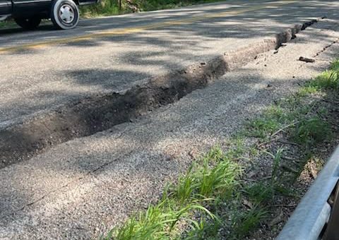
SHOALS — A sudden landslide has forced the immediate and indefinite closure of a major southern Indiana highway, disrupting regional travel and prompting a swift emergency response from state transportation officials.
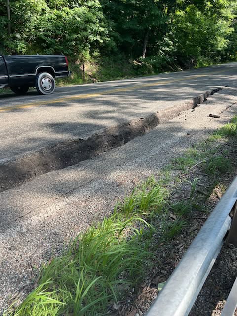
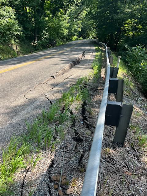
The Indiana Department of Transportation (INDOT) announced that U.S. 50 in Martin County is completely closed in both directions between the town of Shoals and State Road 60.
The landslide occurred just under five miles east of the critical U.S. 50/U.S. 150 split, an area characterized by steep, rolling terrain that can become unstable during periods of heavy saturation or shifting ground.
- Location: U.S. 50 in Martin County, between Shoals and State Road 60 (~5 miles east of the U.S. 50/150 split)
- Status: Closed to all traffic until further notice.
- Cause: Active hillside landslide spilling debris onto the roadway.
- Action Required: All motorists must utilize alternate regional routes.
INDOT Evaluating Slope Stability
INDOT engineers and emergency crews are currently on-scene evaluating the severity of the slide. Geotechnical experts must determine if the hillside is still actively moving before heavy machinery can safely begin clearing the mud, trees, and rock debris blocking the driving lanes.
Landslides in this region of the state typically present a significant hazard to motorists, as sudden earth movements can undermine the structural integrity of the roadway itself or cause additional debris to cascade down without warning. INDOT has not yet established an estimated timeline for reopening the highway, emphasizing that safety and slope stabilization are the top priorities.
Detour and Alternate Routes
With a complete block on this heavily trafficked corridor, local and commercial drivers will experience significant delays. Commuters traveling between Bedford and Shoals or accessing the nearby Martin State Forest will need to bypass the area entirely.
While INDOT works to establish an officially signed detour, regional drivers are advised to utilize the following state highway networks to navigate around the closure:
- Northbound/Southbound Detours: Consider utilizing US 231 or State Road 37, depending on your starting coordinates.
- Eastbound/Westbound Alternatives: Motorists can transition to State Road 60 or State Road 58 to avoid the bottleneck entirely.
Local traffic will have access up to the point of the physical closure, but through traffic is strictly prohibited. Drivers are reminded to slow down, watch for emergency vehicle lighting, and strictly obey all temporary barricades. Real-time traffic updates and official detour changes can be monitored through INDOT’s regional social media pages or via the CARS traffic mapping system.

