


INDIANA — National Weather Service survey teams have confirmed that three tornadoes touched down in Northern Indiana during Tuesday’s severe weather event, bringing the state’s total to six tornadoes just three months into 2026.
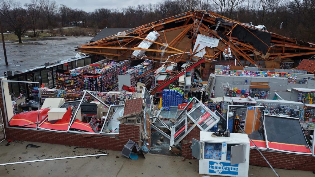
The Tuesday outbreak was characterized by high-intensity storms that carved paths through northwestern counties. The most powerful of the trio was an EF3 tornado that struck Lake Village in Newton County at peak intensity. Further east, an EF2 tornado was confirmed near Knox in Starke County, while an EF1 touched down in Wheatfield in Jasper County.
Indiana’s weather has been uncharacteristically volatile this year. Statistically, the state averages only one tornado in February and two in March. By mid-March 2026, Indiana had already tripled its typical early-season volume.

The year’s activity began on February 19, when a separate storm system produced three confirmed tornadoes:
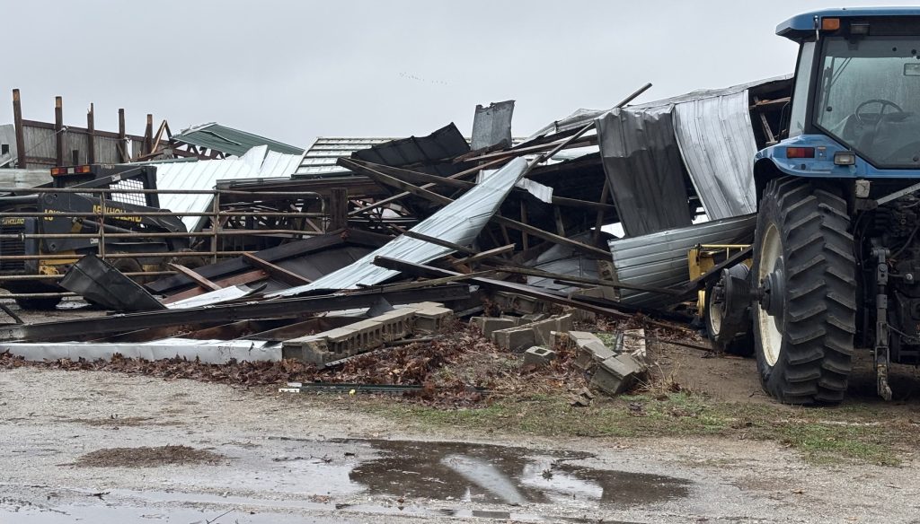
- Sullivan County: An EF0 tornado crossed over from Illinois, tracking 4.1 miles and causing significant damage to outbuildings near Carlisle and Paxton.
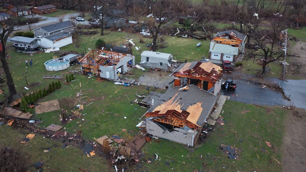
- Monroe County: An EF2 tornado developed near the Monroe County Airport shortly before 7:00 p.m. with 120 mph winds. The 3.7-mile track left a trail of destruction, damaging an airplane hangar, homes, and a newly built apartment complex.
- Decatur County: An EFU (Unknown) tornado was caught on video west of Greensburg. Because it hit an open area and left no damage, wind speeds could not be officially estimated.
Historical Context: 2026 vs. Recent Years
The current pace of six tornadoes by March 12 is notable when compared to Indiana’s annual average of 22 tornadoes. However, it still trails the record-breaking pace of recent years.
| Year | Total Confirmed Tornadoes | Notable Events |
| 2011 | 72 | Highest on record for Indiana |
| 2025 | 62 | 25 tornadoes occurred in a single day (April 2) |
| 2026 (To Date) | 6 | Three EF2+ tornadoes already recorded |
Meteorologists from NWS Chicago and NWS Northern Indiana are still on the ground assessing damage in rural pockets of the state. Officials warn that the count of six could rise as survey teams determine whether specific pockets of destruction were caused by straight-line winds or additional small-scale vortexes.
Weather experts say it has been an exceptionally active start. Residents are urged to remain weather-aware throughout the remainder of March, which historically serves as the gateway to Indiana’s peak tornado season in April and May.
As of Thursday morning, March 12, 2026, flood warnings remain in effect for the East Fork White River across Lawrence and Martin counties. While river levels are gradually beginning to recede in some areas, moderate flooding continues to impact local infrastructure and travel.
Current Flood Conditions
| Location | Observed Stage (March 11–12) | Flood Status | Forecasted Subside Date |
| Bedford | 28.1 ft | Moderate | Wednesday, March 18 |
| Rivervale | 28.0 ft (Crested at 31.0 ft) | Minor/Moderate | Wednesday, March 18 |
| Shoals | 27.1 ft | Moderate | Monday, March 16 |
| Williams | 14.8 ft | Moderate | Thursday, March 19 |
Flood stage for Bedford and Shoals is 20.0 feet.
Local Impacts and Road Closures
The National Weather Service and local authorities report significant disruptions across the flood plain:
- Lawrence County: Extensive flooding is in progress. At current levels, only State Road 37 and U.S. Highway 50 remain open across the East Fork White River flood plain in the Bedford area.
- Access Issues: The Buddha Bypass Bridge is currently inaccessible. Several local roads, including Duncan Road, Tunnelton Road, and Old Buddha Road, are underwater. Access to the Bedford Boat Club remains blocked.
- Martin County: Portersville Road West is closed in multiple locations, specifically east of County Road 500 West and between CR 650W and CR 660W.
- Williams: Backwater from the river has closed Dillman Road. Residents traveling to Williams are advised to use Ridge Road as an alternative.
While the immediate threat of severe storms has passed, saturated soil and an additional 0.75 to 1.25 inches of rain expected through Friday morning may cause secondary crests or slow the rate of recession.
Emergency management continues to urge residents to follow the “Turn Around, Don’t Drown” protocol. Most flood-related fatalities occur in vehicles, and water as shallow as 12 inches can be enough to sweep away a small car.

