

BEDFORD — A violent outbreak of severe weather and suspected tornadoes tore across Southern and Southwest Indiana on Sunday evening, leaving a trail of collapsed structures, submerged vehicles, widespread power outages, and extensive tree and property damage.
Two distinct rounds of supercell thunderstorms slammed the area. These tracking systems unleashed rotating storms directly over communities stretching from the Illinois border eastward through the heart of the state, prompting overlapping Tornado and Severe Thunderstorm Warnings late into the evening.
Destruction in Southwest Indiana and Apartment Collapse
The storm’s path of destruction began heavily in Southwest Indiana, where a violent rotating supercell passed dangerously close to Fort Branch and the Toyota Indiana plant south of Princeton. In Gibson County, Sheriff Bruce Vanoven reported that several homes were “completely obliterated,” though miraculously no severe injuries were immediately confirmed.

Further south in Warrick County, the town of Newburgh bore the brunt of a direct tornado hit. The storm struck the Park Place Apartments retirement community, causing a catastrophic structural collapse of two roofs. First responders engaged in an emergency search-and-rescue operation, successfully extricating a woman trapped inside the debris.
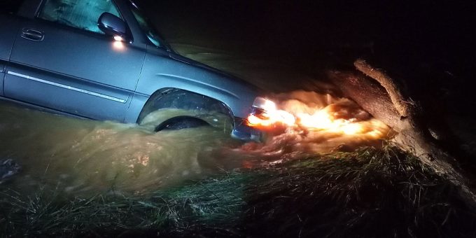
Submerged Vehicle Rescue in Daviess County, Flooding in Loogootee
As torrential rain fell at rates of multiple inches per hour, catastrophic flash flooding quickly overwhelmed local roads. Emergency crews in Daviess County were dispatched to a life-threatening water rescue at the intersection of 1200 East and 150 North.
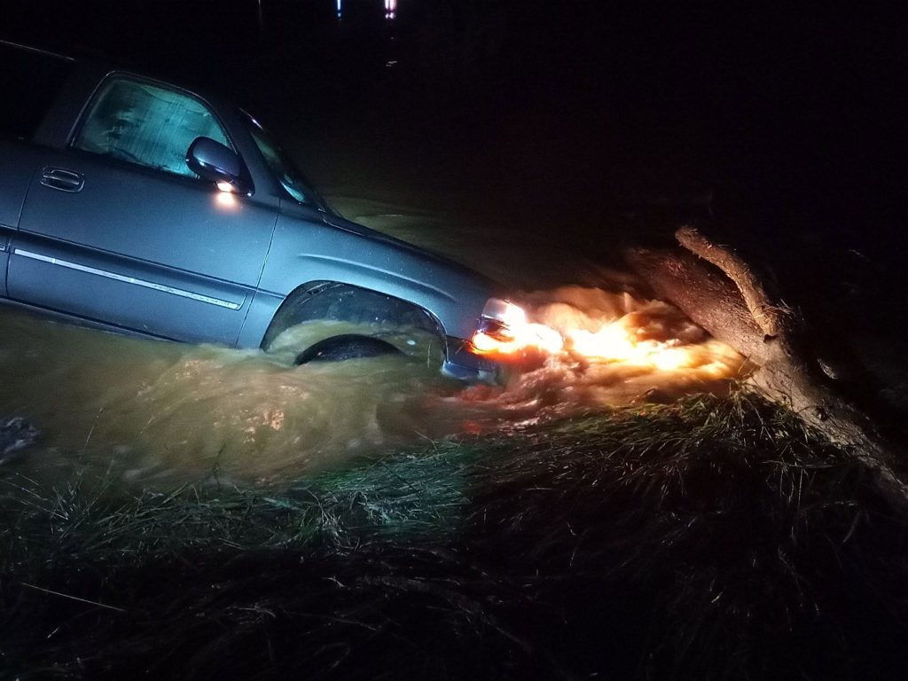
Dispatchers received frantic reports of a vehicle completely submerged in high water with a person trapped inside. Cannelburg firefighters arrived on the scene to find one individual stranded on the roof of the vehicle. Due to the dangerous depth of the water, additional rescue boats from the Washington City and Washington Township fire departments were rushed to the scene to pull the victim to safety.
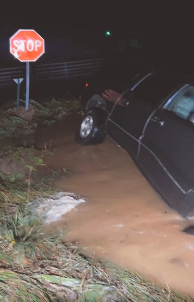
Just to the east, the city of Loogootee in Martin County was hit extraordinarily hard by rapidly rising waters. Local municipal leaders and law enforcement are strictly urging all motorists to use extreme caution, as multiple city streets became entirely impassable overnight.
Widespread Impact on Lawrence County and Surrounding Areas
As the line of supercells tracked eastward, it slammed into Lawrence County and surrounding neighbors, including Monroe, Martin, Greene, and Orange counties. The National Weather Service in Indianapolis issued a continuous string of Severe Thunderstorm Warnings for Lawrence County, tracking radar-indicated rotation and clocking destructive straight-line wind gusts up to 70 mph.
Orleans officials reported that a power pole was down on Lincoln Street and East Vincennes Road. As well as a tree down on Lincoln Street between Jackson Street and State Road. 337.
The high-velocity winds caused extensive damage across the Bedford and Mitchell areas:
- Structural Damage: Reports indicated damage to residential roofs, outbuildings, and mobile homes throughout the path of the storm.
- Roadway Blockages: Hundreds of trees were snapped or uprooted, throwing heavy limbs and debris across county roads. High-voltage power lines were torn down, with utility poles snapped along multiple main arterials.
- Regional Travel Delays: The impacts mirrored those of adjacent Monroe County, where downpours and debris forced the temporary closure of major state routes, including sections of Interstate 69 and US 231.
Thousands Left in the Dark
Utility providers worked around the clock under treacherous conditions to stabilize the power grid. At the peak of the storm, the number of power outages climbed rapidly:
- Duke Energy reported nearly 2,000 customers lost power simultaneously near Sullivan.
- WIN Energy REMC flagged more than 1,000 outages across northern Sullivan County, alongside several hundred additional blackouts stretching across Knox County.
- Local REMC cooperatives in Lawrence and Monroe counties deployed emergency crews to cut through downed trees that had become tangled in live electrical lines.
Motorist Advisory
Local highway departments and emergency management agencies urge drivers to exercise extreme caution during the morning commute. Numerous secondary roads remain closed due to standing floodwaters, hanging trees, or unresolved utility debris. Drivers are strictly warned to never attempt to navigate through flooded roadways—Turn around, don’t drown.

