


BLOOMINGTON – The City of Bloomington’s Information & Technology Services (ITS) Department has released the Bloomington Community Map. This new online tool makes it easier for residents, businesses, and visitors to find helpful information about the city.
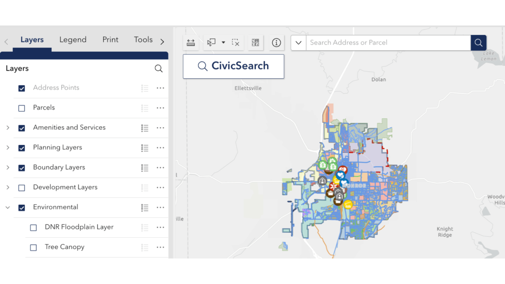
With intuitive navigation, the map enables users to find essential information about their community quickly, promoting transparency and engagement. The application offers a way to display information such as:
- Nearby amenities and services, including parks, trails, and public facilities
- Zoning and parcel details
- Neighborhood boundaries, council and school districts, and voting precincts
- Floodplain layers and tree canopies
- Area demographics
“The Community Map seeks to make information as easily accessible as possible,” said Meghan Blair, GIS Manager. “By having this data at their fingertips, residents have a new tool when deciding where to buy a home, open a business, or even just enjoy a leisurely park visit.”
A key feature of the Community Map is the CivicSearch address lookup, a built-in search tool that allows users to type in an address and instantly view the amenities, zones, and boundaries associated with that location. This functionality makes it simple for residents to learn more about their property and neighborhood.
The Community Map also includes a dashboard that provides a quick snapshot of Bloomington. The dashboard summarizes census population metrics—such as total population, median age, and housing characteristics—along with community features like miles of trails and sidewalks, offering residents a broader view of the city alongside the interactive map.
The Community Map is powered by the City’s Geographic Information Systems (GIS) program, which provides data and mapping tools used across city departments to support operations and planning.

