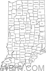
INDIANA – Division of Water Floodplain Mapping is updated on the Indiana Department of Natural Resources website.
The Best Available Flood data updates have been completed in the last two months, December 2023 – January 2024. Data has been updated for the following counties, with specific updated stream(s) in parenthesis:
- Grant (Hopcus Run)
- Lake (UNT Main Beaver Dam Ditch)
- Tipton (Round Prairie Ditch)
- Dearborn (Wilson Creek)
- Ripley (UNT Cedar Creek)
- Posey (Harmony Creek)
- Stark (UNT Robbins Ditch)
- Fountain (Prairie Creek)
- Crawford (UNT Ohio River)
- Starke (East Arm Payne Ditch)


