


INDIANA – Arctic air will move into central by Sunday morning and persist into next week.
This morning, the National Weather Service issued a hazardous weather outlook for Bartholomew, Brown, Daviess, Greene, Jackson, Lawrence, Martin, and Monroe counties.
Today, wind gusts could be up to 30 miles an hour through midday. Winds will return after midnight with gusts up to 35 miles per hour.
Tonight rain is likely after 4 a.m. with a low of around 35. The chance of percipitation is 70 percent with between a tenth to a quarter of an inch of rain possible.
A potent storm system will bring wind gusts of 40 to 50 mph on Friday night into early Saturday. The storm will also bring some light snow Friday after 10:00 p.m. into Saturday, with up to three inches of snow possible.
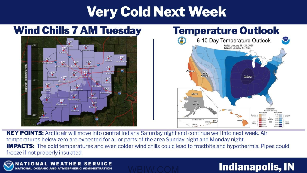
Frigid temperatures will fall below zero for all or parts of the area on Sunday night and Monday night. Wind chills approaching 20 below are possible on Monday and Tuesday mornings.
Hoosiers are warned that the cold wind chill could lead to frostbite and hypothermia.

