

LAWRENCE CO. – With a cold front is moving into the area and it will bring thunderstorms.
Lots of haze again today. Air quality alerts are in place through midnight for unhealthy conditions.
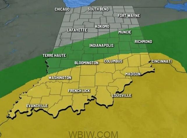
The National Weather Services reports there are numerous chances for thunderstorms over the next several days. Some stronger storms may form this afternoon and again Tuesday night into Wednesday that could produce damaging winds, hail, and flooding.
The best chance of a thunderstorm today will develop along and south of I-70. Some of the thunderstorms may be on the stronger side with gusty winds and moderate to heavy rainfall. There’s a slight risk some of the thunderstorms may reach severe criteria in southern Indiana.
A line of thunderstorms will hit between 4 p.m. and 7 p.m. and move into southeast Indiana first.

That line will move east across our area between 6 p.m. and 10 p.m. This is when we could see a few strong to severe storms. Large hail is the top concern followed by damaging wind gusts.
The increased cloud cover and rain-cooled air will bring cooler temperatures.
Looking ahead to Tuesday, we’ll see some periods of dry time, with stray showers or storms possible in the afternoon. Highs again will be in the low 80s.
Wednesday brings another round of showers and storms, as well as increased humidity, with highs in the low 80s.
Thursday will be the hottest day of the week, with highs in the upper 80s.

