

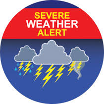
INDIANA – A cluster of storms moved into the state this morning. Not everyone will be impacted by these storms as they dive southeast, but those that do could experience strong to severe storms.
Smog continues to hover over Indiana from the wildfires in Canada.
All severe weather threats are in play and will reach parts of Indiana before 8 a.m., especially in southwestern Indiana. A few warnings will be possible with the main threat being hail and wind damage.
An isolated tornado can’t be ruled out.
By this afternoon, heat will steadily build and haziness will remain, as temperatures reach the upper 80s in many locations. Additional storms will be possible too with another storm complex developing and moving across the state. This will bring the threat again of wind damage, hail, and a slight possibility of a tornado. These storm chances could take us into the evening, so be sure to be weather aware and continue to follow WBIW.com for weather updates.
This unsettled pattern will remain through the beginning of the holiday weekend bringing daily chances for rain and storms through the weekend and into next week but there will also be many dry hours each day. Humidity is set to surge with a tropical feel on Friday and Saturday. More heat and humidity will keep the last days of June above average.

