

(WEST LAFAYETTE) — The National Oceanic and Atmospheric Administration and National Weather Service Central Region have released their winter outlooks, with La Niña factoring heavily into their predictions.
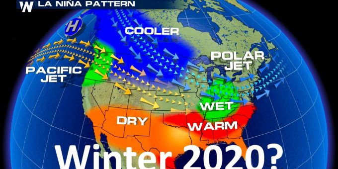
For Indiana, a La Niña winter has historically been associated with wetter than normal conditions, although the temperature probabilities are inconclusive for most of the state. Mid-October brought the first freeze for most of the state, with the southern Ohio River Valley being a notable exception with intermittent frost appearing in this area. The freeze event was approximately on par with normal climatological dates.
After a record dry September across central Indiana, rains in October have helped alleviate some of the long-term dryness. The National Weather Service in Indianapolis reported over 90% of the state fell into abnormally dry conditions, with over half the state in a moderate drought, according to the U.S. Drought Monitor.While drought conditions have improved in many areas of the state over the last week, the seasonal drought outlook calls for persistent dry conditions in central Indiana.
This outlook seems to conflict with the La Niña prediction of conditions that tend to produce an above average chance of precipitation. However, the predictions can be understood if you break down the winter season by months. While areas of drought are predicted to persist into the winter time frame, the end of the season (February and March) may provide enough rainfall to bring the average over the time frame above the climatological normal. Climate change in Indiana, according to the Purdue Climate Change Research Center, includes more periods of drought and more extreme precipitation events causing flooding. The winter outlook includes this probability by acknowledging precipitation deficits to start the period with a shifting jet stream to increase precipitation by the end of February.
Meanwhile, all forecasts and climate outlooks have a certain level of uncertainty. The last La Niña winter in our area, 2017-18, featured a rather dry and cold December and January, with a wet February. The temperature signal corresponded to a less active Arctic Oscillation, allowing cold air to press further south. These smaller temporal oscillations can influence, exacerbate, or block the temperature and precipitation trends we would expect from La Niña.

“With our climate changing at the pace it has been, it is difficult to look at La Niña events from the 1950s through 1970s and assume similar weather and climate conditions today,” said Beth Hall, Indiana state climatologist.
This leaves very few La Niña years in recent decades to draw a lot of confidence for what this season will bring.
For more information on the seasonal outlook, contact Hans Schmitz at the Purdue Extension – Posey County office via hschmitz@purdue.edu or 812-838-1331, or the Indiana State Climate Office at 765-494-8060.
Information Beth Hall, hall556@purdue.edu

