

(BEDFORD) – For public safety during maintenance activities on October 22 and 23, the USDA Forest Service will temporarily close all National Forest System land located in the area bounded on the west by State Road 446, on the north by Tower Ridge Road, and on the south and east by Hunter Creek Road, as reflected on the map for Closure Order 09-12-20-10.
This includes portions of the Charles C. Deam Wilderness, Grubb Ridge Trailhead, Blackwell Horse Camp, Brooks Cabin, Cope Hollow Trail, Martin Hollow Trail and Hunter Creek Trail.
In addition, Monroe County Highway Department will close Tower Ridge Road from the intersection of Last Horse Lane east to the intersection with Hunter Creek Road for this period.
The remainder of the Charles C. Deam Wilderness and Tower Ridge Road will remain open and can be accessed from the west via Hays Road or Hunter Creek Road.
Maintenance activities include transporting materials in preparation for rerouting a section of Cope Hollow Trail at a future date.
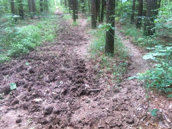
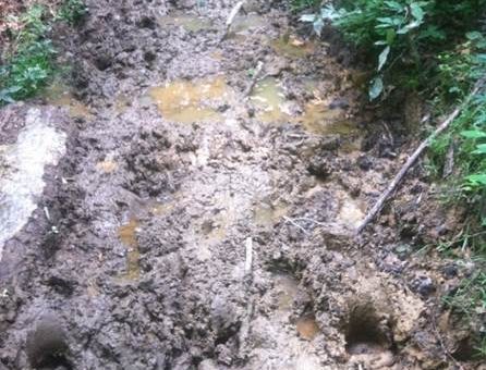
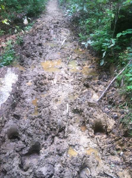
Approximately 3700 feet, or 0.7 miles, of the trail is planned to be rerouted due to poor trail location in an old entrenched roadbed, a lack of proper drainage, soil type, trail width, and heavy horse use which have created significant resource damage; compromising trail sustainability, wilderness trail standards and wilderness character. In addition, trail braiding is occurring due to poor trail surface and old roadbed width, creating new user-made trails and damaging vegetation.
For up-to-date information on the Hoosier National Forest, visit https://www.fs.usda.gov/hoosier, and https://www.facebook.com/HoosierNF, or call 812-275-5987.

