

SEYMOUR — As construction season kicks into high gear across the Hoosier State, the Indiana Department of Transportation (INDOT) is reminding motorists that staying informed is the best way to navigate upcoming roadwork, particularly on the ambitious Safer Drive 65 project.
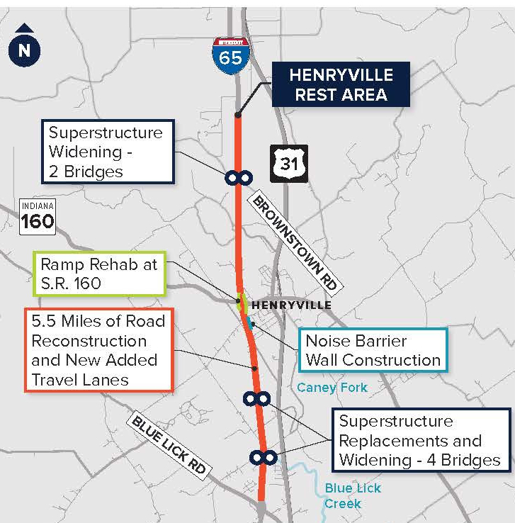
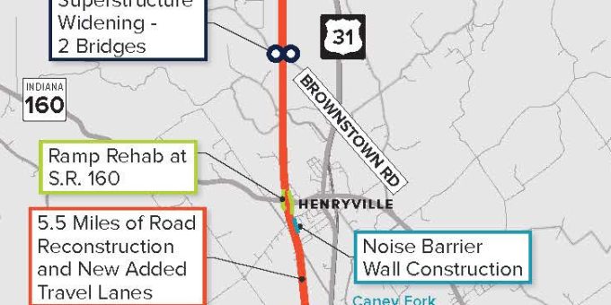
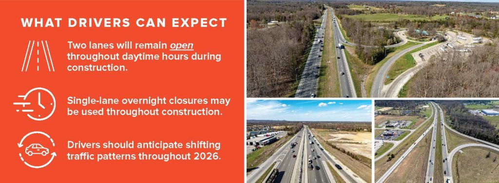
The $143 million multi-year initiative aims to modernize a 13-mile stretch of Interstate 65 between Blue Lick Road in Clark County and State Road 56 in Scott County. With significant bridge work and lane additions scheduled throughout 2026, real-time updates have become an essential tool for local commuters.
How to Monitor Your Commute
INDOT provides several digital platforms for motorists to track the progress of Safer Drive 65 and other regional infrastructure improvements in Southeast Indiana:
- Social Media: Follow INDOT Southeast on Facebook and @INDOTSoutheast on X (formerly Twitter) for immediate alerts on lane shifts and emergency closures.
- TrafficWise: Visit 5 511in.org for a live look at road conditions, traffic speeds, and active construction zones.
- Mobile Apps: Real-time data is also available via the INDOT app on both the iTunes App Store and the Google Play Store for Android.
2026 Project Milestones
The current phase of the Safer Drive 65 project focuses on several key bridge locations where overnight lane closures are expected through early spring. These include:
- I-65 over Blue Lick Creek (Mile Marker 16.5)
- I-65 over Caney Fork (Mile Marker 17.4)
- I-65 over Brownstown Road (Mile Marker 21.2)
Crews are working to add a third travel lane in each direction and reconstruct aging pavement to meet future traffic demands. The overall project is currently on track for a winter 2027 completion.

