


LAWRENCE CO. — The National Weather Service in Indianapolis has issued a Tornado Watch for Lawrence County and much of Southern Indiana, effective until noon today, Wednesday, March 11.
The watch comes as a line of strong storms moves through the region, bringing the potential for atmospheric conditions favorable to the development of tornadoes, damaging winds, and hail. This alert follows a night of severe weather across the Midwest that has already caused significant damage in parts of northern Indiana and Illinois.
The watch area encompasses 13 counties across the southern and central portions of the state, including:
- Lawrence County
- Monroe County
- Daviess County
- Martin County
- Greene County
- Jackson County
- Brown County
- Orange County
Wind Advisory Also in Effect
In addition to the tornado threat, a Wind Advisory remains in effect for the region until 5:00 p.m. today. Forecasters expect sustained southwest winds of 15 to 25 miles per hour, with gusts reaching up to 50 mph. These winds may be strong enough to knock down tree limbs and cause isolated power outages, even outside of any thunderstorm activity.
Safety Precautions
During a Tornado Watch, residents should remain “weather aware” and be prepared to take action if a Warning is issued. Key safety steps include:
- Identify Your Safe Place: Have a sturdy interior room or basement ready for immediate use.
- Charge Devices: Ensure cell phones and weather radios are charged in case of power failure.
- Monitor Alerts: Keep a battery-operated radio nearby or stay tuned to local news for rapid updates.
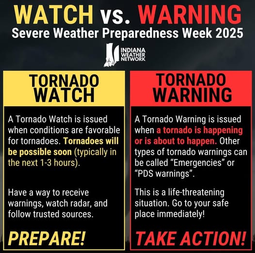
Public safety officials remind residents that while a watch means conditions are favorable for a tornado, a warning means a tornado has been sighted or indicated by radar and immediate shelter is required.

