

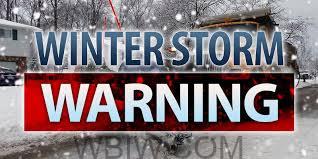
INDIANA – A significant winter storm will be impacting Indiana later this week. It is expected to move through the area Thursday through the weekend with heavy rain, accumulating snow, high winds, sub-zero temperatures, and dangerously low wind-chill readings.
The National Weather Service in Indianapolis issued a Special Statement about the storm Sunday afternoon alerting citizens that the exact storm track and where areas of heavy snowfall could set up is still uncertain.
But the Weather Service adds confidence remains high in the dangerously cold air threat and high wind potential.
The worst travel day will be on Friday with the combination of snow and polar air, along with strong gusts will create some hazardous travel statewide.
Snow will begin to crank up before sunrise Friday morning. Snow will begin accumulating quickly, as temperatures drop steeply and winds turn quite gusty. This will result in near-whiteout conditions off and on for Friday and into early Saturday morning.
Extremely cold arctic air this weekend will see temperatures falling below zero. Dangerous wind-chill readings could possibly reach 20 to 30 degrees below zero this weekend.
The statement issued by the National Weather Service says snowfall amounts remain very uncertain at the moment.
And the Weather Service adds citizens need to stay alert to the forecast and possible changing weather conditions throughout the week.
The forecast for the Danville area is calling for a 50-percent chance of snow after midnight on Wednesday, with a low temperature that night around 25. Thursday and Thursday night are expected to be blustery with an 80-percent chance of snow. Thursday’s high is expected to be near 30 degrees, but that night the low is likely to plunge to around 3 degrees – with snow and blustery conditions continuing. On Friday there is a 50-percent chance of snow in our forecast, with a high only near 10 degrees with cold winds continuing.

