

(BEDFORD) – Snowfall will begin tonight and will continue through early Tuesday morning.
The biggest threats to motorists and residents will be heavy snow, blowing winds, and dangerously low temperatures.
There could be power outages and those outside should bundle up to prevent hypothermia.
This storm will come in two waves.
Snow late tonight will impact the Monday morning commute.
The National Weather Service predicts snow will begin to fall around 7 p.m. tonight or after, with one to three inches falling by morning.
Winds will be around 13 miles per hour causing blowing and drifting snow and bitter wind chills.
There will be a lull between 7 a.m. until afternoon on Monday with the heaviest wave beginning possibly around 2 p.m.
The evening rush hour is expected to be treacherous with one to two inches of snow falling per hour, with strong winds and drifting. Winds will gust up to 30 miles per hour with low visibility of a quarter of a mile to a half a mile or less at times.
Blowing and drifting as well as low visibility and cold temperatures will make for dangerous conditions, and continue to impact travel on Tuesday morning.
Officials say secondary roads could become impassable.
With the wind chill the temperatures will be well below zero.
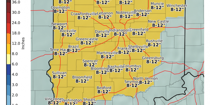
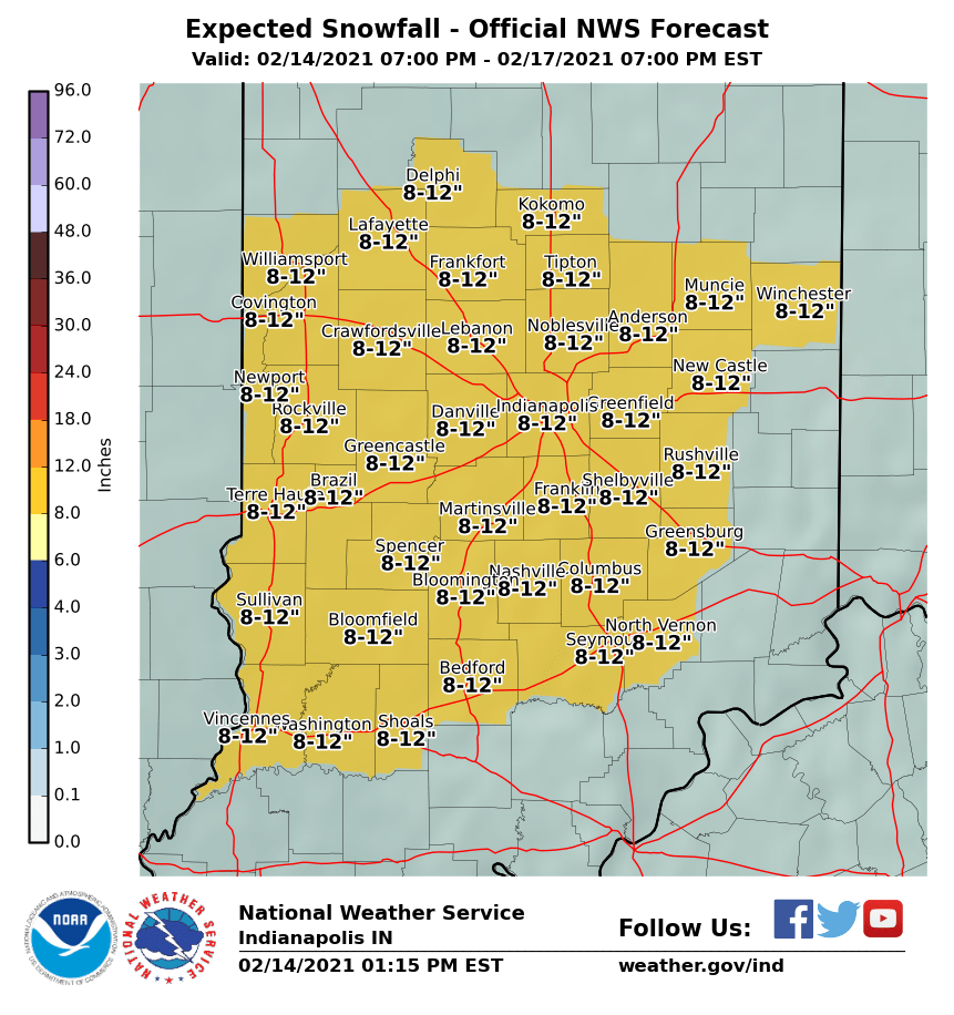
Officials are estimating between 8 to 12 inches across the state with some areas possibly accumulating more.
1340 AM WBIW, Super Oldies 105.5 WQRK, and Lite FM 102.5 WPHZ will keep you updated on weather, traffic, and emergency information throughout this winter storm.

