

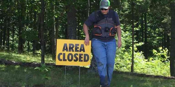
(BEDFORD) — Because of recent storm impacts, all trails on the Brownstown Ranger District in Monroe, Jackson, Brown, and Lawrence counties are closed to public access.

This includes all trails in the Charles C. Deam Wilderness Area.
The following areas are ordered closed until termination of this emergency closure order or 180 days from the signature date, whichever comes first:
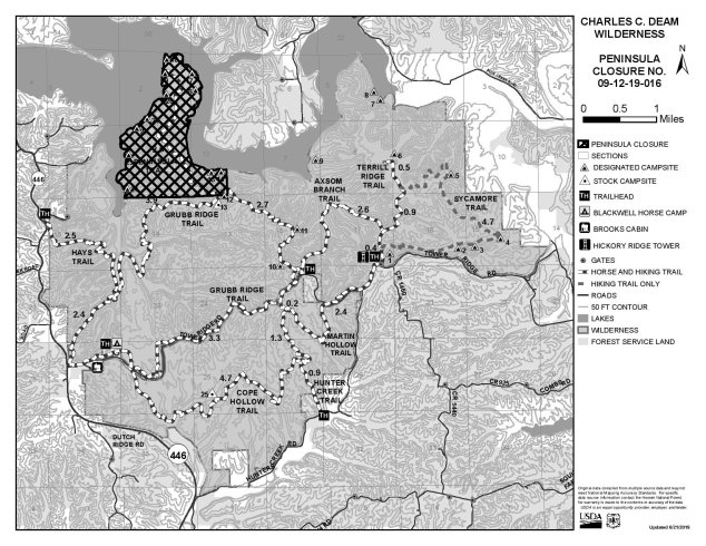
The Peninsula area of the Charles C. Deam Wilderness area within the Brownstown Ranger District, in Brown and Monroe Counties, Indiana, north of the Grubb Ridge trail no. 405.10, extending from the junction of the Grubb Ridge trail and the Peninsula trail no. 405.60 and extending west from that junction to Monroe Lake Reservoir, and described as:
- All NFS land located within Sections 2 and 11, T7N, R1E, 2nd P.M., Monroe County, Indiana.
- All NFS land located in that part of Section 10, T7N, R1E, 2nd P.M., Monroe County, Indiana, lying east of the waters of Monroe Lake.
- All NFS land located in that part of Section 1, T7N, R1E, 2nd P.M., Brown County, Indiana, lying west of the waters of Monroe Lake.
- All NFS land located in the Southwest Quarter of Section 12, T7N, R1E, 2nd P.M., Brown County, Indiana.
This popular spot for shoreline camping on Monroe Lake experienced extensive damage during last weekend’s storms and possible tornado. Potential dates to reopen this area are currently unknown. Crews have already begun assessing damage and formulating plans for mitigating safety hazards.
Due to this area’s status as a congressionally designated wilderness area, motorized equipment is not permitted, so cleanup efforts will rely on more hands-on methods.
Visit https://www.wilderness.net/NWPS/WhatIsWilderness to learn more about wilderness areas.
This area closure is in addition to the closure of all trails on the Brownstown Ranger District in Monroe, Jackson, Brown, and Lawrence Counties announced on Monday. This includes all trails in the Charles C. Deam Wilderness Area. Additionally, the Shirley Creek trail in Orange County is also closed. These emergency closures will be in place until Forest Service personnel are able to assess the extent of the damage and take appropriate measures to ensure visitor safety.
Shirley Creek trail in Orange County is also closed.
These emergency closures will be in place until forest service personnel are able to assess the extent of the damage and take appropriate measures to ensure visitor safety.
Additional rain and storm activity are expected across the forest this week. Conditions may continue to worsen over the coming days. Use extreme caution when driving through the forest. Roads may be impacted by standing water or flash flooding.
For more information about closure orders on the Hoosier National Forest, visit www.fs.usda.gov/alerts/hoosier/alerts– notices or call 812-275-5987.

